
Sairme Pillars, Georgia: how to get there and the 3 km trail
The rock towers of Sairme in Lechkhumi: where they are, how to drive from Kutaisi and Ambrolauri, the 3 km trail with Labechina church, and the best season to visit.
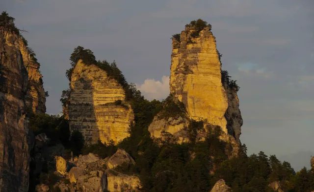
You can see the Sairme Pillars before you reach them. The road runs along the floor of the Rioni gorge, forest climbs the slopes, and at some point stone towers with clean vertical faces rise above the trees. There is no sign, no pointer, no viewpoint at that moment: just rock above the treeline, and you pull over to work out what you are looking at.
The place is still quiet. No ticket booth, no barrier, no buses, no café with “viewpoint” on the sign. In Georgia, where every well-known waterfall already has a car park and a souvenir stall, that is rare.
What the Sairme Pillars are and where they stand
The Sairme Pillars, or Sairme Columns (Georgian: Sairmis svetebi), stand in the Racha-Lechkhumi and Lower Svaneti region, in Tsageri Municipality. The rocks sit on the right bank of the Rioni, between the villages of Chrebalo and Alpana. Tourists did not invent the name: people from the three nearest villages, Chrebalo, Alpana and Sairme, have called them this for generations.
Geologists explain the shape as a block structural landslide: the massif shifted and split so that pyramid-like and horn-shaped towers with sharp vertical walls remained on the surface. That is why they feel man-made. The Pillars look more like architecture than geology, and nothing else in Georgia resembles them. The massif sits at roughly 700 metres above sea level.
Lechkhumi is rich in natural and historical sights, but the Pillars have become its best-known view. Driving along the Rioni from Ambrolauri, the formation opens above the forest on your right long before the trailhead. Worth stopping on the shoulder for a full-frame photo: from the trail you will not get that wide view.
Getting to the Sairme Pillars
Transport matters more here than the hike itself. The Pillars stand in mountains with almost no tourist infrastructure, and logistics take longer than the climb.
Distances from major cities:
- from Tbilisi — about 251 km
- from Kutaisi — about 50 km
- from Ambrolauri — about 35 km
By your own or a rental car
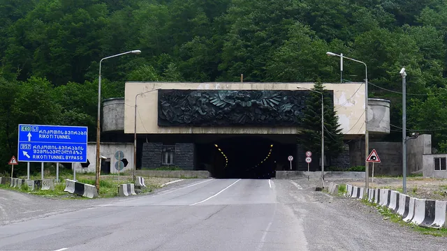
This is the calmest option. From Kutaisi the road reaches the Rioni and then follows the river through the gorge: fifty kilometres on the map become a little over an hour of driving because speeds stay low and the road winds. At Alpana the highway splits, one branch to Racha and Ambrolauri, the other into Lechkhumi towards Tsageri, and views of the massif start appearing on this stretch.
Asphalt holds almost to the trail start. The last section, about a kilometre, is stony dirt: a normal car can manage it if you take it slowly, but after rain a higher clearance helps. There is no proper car park at the trailhead; people leave cars on the roadside.
Your own car also solves a second problem: the Pillars fit easily into one day with other stops in Lechkhumi and Racha, which bus timetables do not allow. Browse available cars at mydrive.club: free delivery in Tbilisi, Kutaisi and Batumi, unlimited mileage.
Marshrutka and taxi
Marshrutkas from Tbilisi run towards Chrebalo, but schedules are irregular and they will not drop you at the trail. After that you need a lift or a walk along the road, and the same on the way back in the evening.
A taxi from Kutaisi or Ambrolauri works and is worth the money if you are three or four. Ask the driver to wait: catching a ride back at an empty junction is nearly impossible. Agree on price and waiting time before you get in.
The “Sairme Columns” trail
An official footpath, the “Sairme Columns” trail, runs to the Pillars: about 3 kilometres one way. It does not need special training, but nobody would call it an easy stroll: almost the whole route climbs through forest slopes.
Start. The trail begins at a small rise on the forest edge. The first metres look deceptively simple, then the slope picks up.
Forest. Next comes a winding path through dense deciduous woodland, gradually gaining height. In summer it is cool and shaded even in heat, but there is almost no view: you just walk up, listening to the trees.
Labechina church. On the climb the trail reaches the medieval Church of the Mother of God in Labechina village. Worth slowing down: a fine example of Georgian medieval architecture, and a good place to catch your breath and drink water.
Final climb. After the church, the last stretch to the top remains. Here the path is rocky in places and disappears in tall grass in others, especially in late summer.
What to bring. Closed shoes with grip, because stones are slippery after rain. Water, a litre or two per person: there are no springs along the way. A rain jacket or windbreaker; mountain weather changes fast. Snacks, because there is nowhere to buy anything on the route.
How long it takes. On average 2–3 hours up and down, plus time to look around and take photos. The hike fits into half a day, which is convenient: you can use the other half for other stops in the region.
What you see at the top
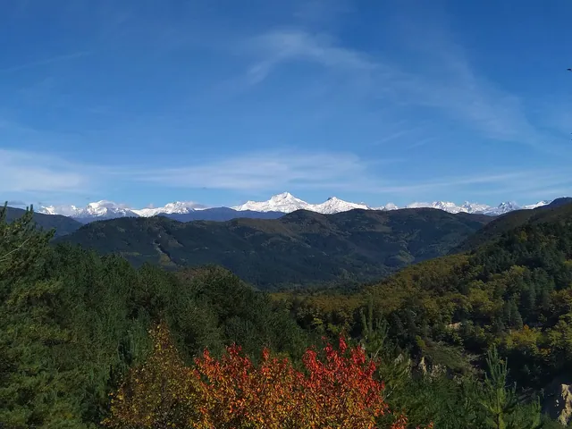
At the summit the Pillars open at once and in full: vertical towers with sharp edges, green slopes below, mountain ridges layered to the horizon. The shape really reads like columns from a ruined temple, only much larger.
The best light is morning and evening. On a misty morning the towers emerge from white milk in parts, the silhouette shifting every few minutes. At sunset side light pulls out shadows and emphasises the rock relief. At midday the light is flat and the cliffs look duller in photos than in person.
The rocks are also used as a rock-climbing training site: the surface and relief suit the sport. If you climb, this is an interesting spot away from Georgia’s usual crags.
Practical details
Season. April to October. In spring the forest is at its greenest, but the trail gets muddy after rain. In summer it stays dry and the path is easy to follow, and the trees protect you from heat. Autumn brings the best colours and the nicest air for the climb. In winter the route is still passable and winter photos look striking, but the trail can be icy, so without experience and proper footwear it is better not to go.
Infrastructure. Almost none: no café, shop or toilet at the trail. Bring everything you need, including a first-aid kit. The nearest shops are in Ambrolauri or on the road from Kutaisi.
Signal and navigation. Mobile reception is patchy in the gorge and on the slopes. Download an offline map in Maps.me or Google Maps in advance and load a track: on a first visit a track is reassuring because the path sometimes vanishes in grass.
Start time. Leave with a buffer before dark. Coming down a stony forest slope at dusk is unpleasant, and not everyone carries a torch.
A day in the region. The Pillars combine easily with other sights in Racha-Lechkhumi: Nikortsminda church, Lake Shaori, villages around Ambrolauri with Khvanchkara vineyards. By car the whole loop fits into one or two unhurried days.
Is it worth going now?
Georgian natural sights grow popular fast. A few years ago mainly locals knew the Sairme Pillars; now more people write about them, but there are still no queues, flag-waving guides or souvenir stalls.
For now it is just forest, stone, wind and one of the finest views in western Georgia. That is what people come to Lechkhumi for.