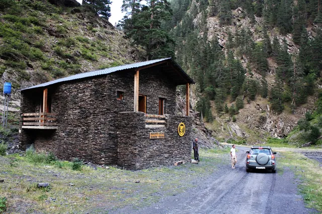

Lagodekhi Nature Reserve: Trails and How to Get There
Georgia's oldest reserve: five marked trails, waterfalls and a border lake at 2,800 m. How to drive from Tbilisi in 2.5–3 hours and what to sort out on arrival.
Lagodekhi Nature Reserve was established in 1912 and remains the oldest protected area in Georgia. It sits 160 km east of Tbilisi, a 2.5–3 hour drive on paved road. Five marked trails run inside it, from a short interpretation path to a three-day trek up to a lake at 2,800 metres on the Dagestan border.
A Brief History: Georgia's First Nature Reserve
The reserve was founded under the Russian Empire by the Imperial Russian Geographical Society. The man behind it was Ludwik Młokosiewicz, a Polish naturalist who spent nearly half a century in Lagodekhi and first catalogued the local flora. That makes Lagodekhi the oldest protected area in Georgia, predating every other national park in the country by more than fifty years. In 2003 the territory was split into two zones: a strict nature reserve open only for scientific research, and a managed reserve open to visitors. Every trail below runs through the second zone.
The combined protected area covers 24,451 hectares, roughly 245 km². Elevations range from 590 to 3,500 metres above sea level. The park borders Azerbaijan to the east and Dagestan (Russia) to the north, and some trails run along the international boundary.
Wildlife and Nature
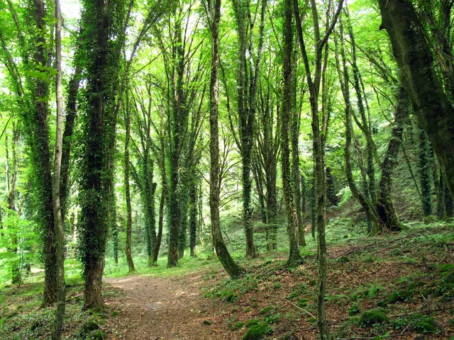
Lagodekhi is one of the few corners of the Caucasus where the forest has stayed genuinely undisturbed. No logging, no grazing since 1912. The climate is continental-subtropical: the gorges stay warm and humid for most of the year, which is where the biodiversity comes from.
Flora. Over 1,400 species of flowering plants have been recorded here. The forests consist of hornbeam, Caucasian oak, beech, linden, maple, birch and ash. Twenty-six plant species found in the reserve are listed in Georgia's Red Book, including chestnut, yew, Caucasian persimmon and bear nut. Lower elevations carry dense undergrowth of lianas and moss; higher slopes open into subalpine meadows.
Fauna. The reserve holds around 150 bird species and over 50 mammal species, plus 12 reptile and 5 amphibian species. Brown bears, lynx, wolves, Caucasian red deer, chamois, roe deer, wild boar, jackals and wildcats live in the mountain forests. Eagles, bearded vultures, griffon vultures and kestrels nest on the alpine plateaus. Birdwatchers come specifically for the Caucasian black grouse and Caucasian snowcock, two species that are close to impossible to find elsewhere. More than 40 animal species are on Georgia's Red Book list.
The reserve holds Important Bird Area status from BirdLife International and is recognised as a special ecoregion by WWF.
Trails: From a Short Walk to a Three-Day Trek
The managed reserve has five marked trails of varying difficulty. All of them are registered at the visitor centre on Vashlovani Street in Lagodekhi town, which also issues maps, advises on trail conditions and books beds in the mountain shelters.
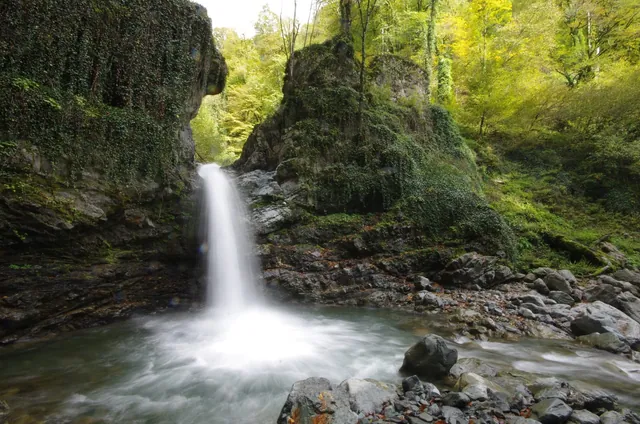
1. Rocho (Black Grouse) Waterfall — 9.5 km / 5.9 mi round trip, 3–5 hours, moderate The busiest route, starting at the visitor centre and following the Shromiskhevi river. It passes hornbeam stands at 400–600 metres, rare in the Caucasus, then mixed beech forest, and ends at a 6-metre waterfall in a rocky amphitheatre. Well marked and manageable for most visitors.
2. Ninoskhevi (Great) Waterfall — 8.5 km / 5.3 mi round trip, 4–6 hours, moderate–hard Leads to a multi-tiered cascade dropping around 40 metres. The trail starts from a separate information centre in Gurgeniani village, not the main entrance, and fords the river several times over wet stones. I did it the first time in ordinary trainers and spent half the crossings knee-deep; a spare pair of sandals and dry socks in a bag now live in my daypack. After heavy rain the makeshift bridges wash out, and the route is better postponed.
3. Machi Fortress — 10.5 km / 6.5 mi, 3–4 hours, moderate Starts in the village of Matsimi, 7 km from the park administration centre, so you need to get there separately. The path runs through Bneli Kheoba, the Dark Gorge, where hazel trees arch overhead under a carpet of moss, then climbs to a medieval fortress above the confluence of two rivers. Sources date it to either the 9th or the 11th century. Horses can be hired at the information centre for this route.
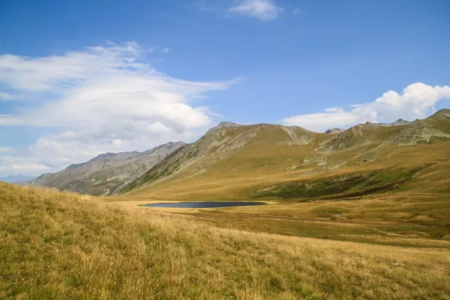
4. Black Rock Lake (Shavtskhali) — loop of roughly 40 km / 25 mi, 3 days, strenuous The flagship trek and one of the best known in Georgia. It climbs from 550 to 2,800 metres, and the lake lies directly on the border with Dagestan. Two shelters sit on the route: Meteo at around 2,000 metres and Demidov's Hut at 2,650. Beds are booked and paid for at the visitor centre, around 20 GEL per person per night, with cheaper camping alongside. A border guard post stands short of the lake: bring your passport or ID, details are recorded on the spot.
5. Nature Interpretation Trail — short, easy, educational Suitable for families and anyone who wants the park without the exertion.
Practical Information
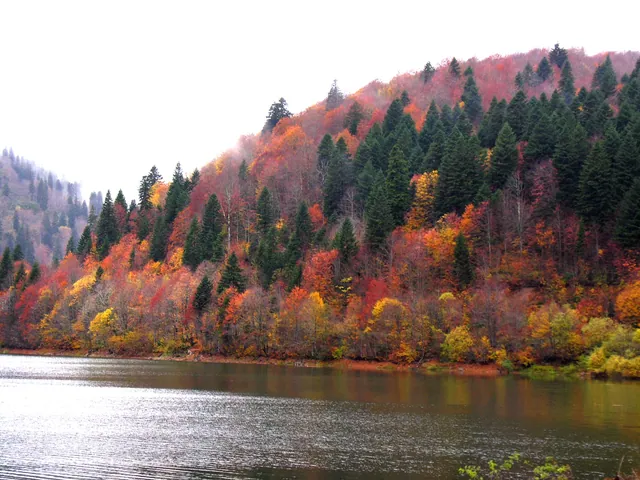
Best time to visit: May to October, with June to September optimal. Winter closes most routes under snow. In early spring, at the height of the rains, Machi is often the only reliably passable trail while the rivers run high. Autumn turns the forest gold and red.
Entry and registration. Entry is free, but registration is mandatory and only happens at the information centre on Vashlovani Street. Overnight permits and shelter bookings are handled there too. Bring ID.
Food. There is nothing to buy at the park gates; cafés and shops stay in town. On my first visit I counted on eating at the entrance and walked the whole day on biscuits from my pack. Stream water is drinkable and the springs are marked on the visitor centre maps, though some dry up by late summer.
Accommodation. Guesthouses and small hotels in Lagodekhi town, several of them on Vashlovani Street minutes from the entrance. Inside the park there are designated camping spots and the two shelters on the Black Rock Lake route.
Getting There from Tbilisi
Distance from Tbilisi: around 160 km (100 miles), roughly 2.5–3 hours east on the Kakheti highway. The road is fully paved, no 4WD needed, a standard car is fine. Telavi to Lagodekhi is 80 km (50 miles), about 1 hour 20 minutes.
Public transport works: marshrutkas leave Isani metro station roughly hourly from around 7:30 am, take the same 2.5 hours and cost somewhere around 10–15 GEL (check locally, fares shift). The problem starts on arrival.
The park has three separate entrances: the main one in Lagodekhi town, a second in Gurgeniani village, a third in Matsimi. Ninoskhevi starts from the second, Machi Fortress from the third. There is no bus and no timetable between them, only local taxis that appear irregularly and price by mood. Without a car you realistically get one trail per day, and only if it leaves from the main gate.
That is why renting a car in Tbilisi is less about comfort here and more about coverage. With a rental from MY.DRIVE you can:
- be on the trail at 8 am while the lower forest is still cool, rather than after the first minibus;
- move between the three entrances in 15–20 minutes instead of waiting an hour for a lift;
- put Lagodekhi in one loop with Sighnaghi, Kvareli and Telavi;
- drive back to Tbilisi in the evening without watching the clock for the last marshrutka.
Food and Wine in Kakheti: What to Eat and Drink in the Region
Lagodekhi is about nature. But it sits in Kakheti, which produces around 70% of all Georgian wine on a winemaking tradition 8,000 years deep, and driving 160 km past that would be odd.
The nearest major wine hub is Kvareli, where the Kindzmarauli Corporation cellars are cut straight into the mountainside. Worth trying: Saperavi, a full-bodied dark red with black-currant notes; Kindzmarauli, a semi-sweet red drunk locally as an everyday wine; Rkatsiteli, either dry white or in the amber style when fermented skin-on in qvevri. More on tastings and estates in the Kakheti wineries guide.
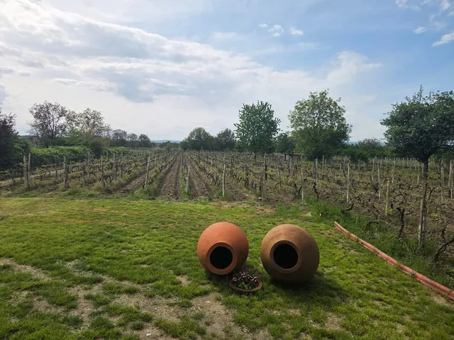
Qvevri are clay amphorae buried up to the neck in the ground, holding wine for months. White grapes fermented with skins and seeds give that amber colour and the taste of dried fruit, honey and nuts.
On the food side, Kakhetian cooking is plain and honest. Mtsvadi is grilled over dried grapevine cuttings rather than charcoal, which is where the smell comes from. Chakapuli is lamb slow-cooked in white wine with cherry plum and tarragon. Shoti bread comes out of a clay tone oven, long and crisp. Sulguni and Imeretian cheese are made on every second farm around here.
How Lagodekhi Differs From Kazbegi and Tusheti
Mostly in the character of the landscape. No open rock panoramas, no glaciers, but dense, humid, almost jungle-like forest with a multi-layered canopy. Trails follow rivers, cut through narrow gorges, pass under trees soaked in moss. You can drink straight from the streams, which is rare on Georgian routes.
And there are far fewer people. Kazbegi in July is a queue of minibuses; on the Rocho trail on a weekday you might pass two or three hikers all day.
Before You Go
- Cash — cards aren't taken everywhere, and shelters and private guesthouses are cash only.
- Passport or ID — required to register at the entrance and to pass the checkpoint on the Black Rock Lake route.
- Layers — it cools off fast at elevation and the forest stays damp all day.
- Proper hiking boots — trails turn to slick clay after rain.
- Insect repellent — leeches appear on the lower sections in warm months.
- Offline maps and a full charge (Maps.me, Gaia GPS) — signal inside the park is unreliable.
- An early start — cooler air, an empty trail, better odds of seeing deer.
Bottom Line
For a single day from Tbilisi, take Rocho or Ninoskhevi: leave at six, reach the waterfall by lunch, drive back in the evening. For two days, sleep in town and walk two trails from different entrances, which needs a car. Black Rock Lake needs three days, a passport and shelters booked in advance. Check river crossing conditions at the visitor centre before you set off, especially in spring.