
Amberd Fortress: how to get there from Yerevan and what to see on the slope of Aragats
Amberd, a 10th–13th-century fortress at about 2,300 m on the slope of Aragats: the road from Yerevan via Byurakan, the Vahramashen church of 1026, the season, the state of the last stretch of road and how to pair it with Lake Kari.
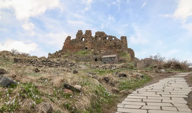
Amberd stands on the southern slope of Aragats at about 2,300 m, roughly 50–55 km northwest of Yerevan. The fortress occupies a triangular promontory between two deep gorges, so cliffs protected it on three sides. The drive takes a little over an hour via Byurakan. The name is usually translated as "fortress in the clouds", and on an overcast day the clouds really do drift straight across the walls.
History of Amberd
The first fortification on this promontory is linked to the Kamsarakan princes and dated to the 7th century, but the fortress as it stands today took shape in the 10th–13th centuries. Its main owners in the 11th century were the Pahlavuni princes, one of the powerful Armenian families of the time. Amberd guarded the approaches to Aragats and the Ararat valley and served as a summer residence.
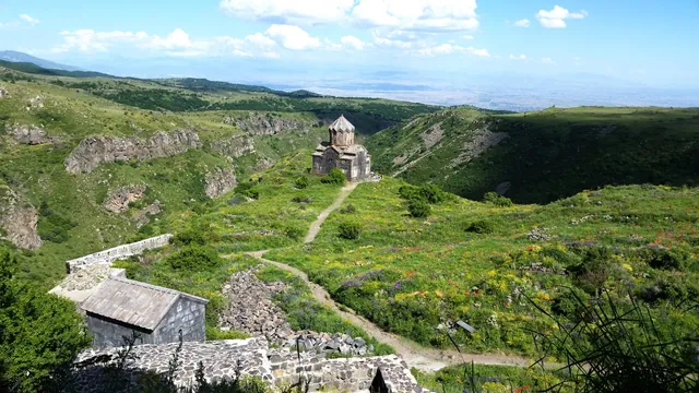
In 1026 Prince Vahram Pahlavuni built a church here, known after him as Vahramashen. It has survived better than the rest of the complex, and most people come specifically to see it.
The fortress then changed hands several times. In the second half of the 11th century it was captured by the Seljuks; at the end of the 12th century the Armenian Zakarian princes took Amberd back and strengthened the walls. In 1236 the Mongols took the fortress, and after that it gradually fell into decline. The walls and citadel were restored later, which is why the masonry looks noticeably newer in places.
What to see
The complex is small; an unhurried visit takes about an hour.
- Vahramashen church. A small cross-domed church of dark stone with a tall drum under the dome. It stands on its own below the citadel on an open terrace. Inside it is bare, but the acoustics are good, and from the doorway you look out over the gorge.
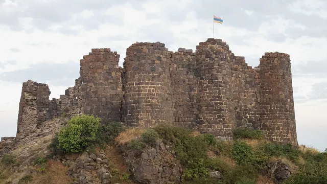
- Citadel. A multi-storey castle on the highest point of the promontory. The walls have been partly restored, and you can usually go inside to see what remains of the rooms and window openings.
- Fortress walls. They run along the edge of the promontory, in places right on the lip of the cliff. You can walk along them, but don't go close to the edge: there are hardly any railings.
- Remains of the bathhouse. Small ruins below the citadel with traces of a heating system. They are easy to miss if you're not watching where you step.
The easiest loop: from the car park first to the church, then up to the citadel, then along the walls to the tip of the promontory and back.
How to get to Amberd from Yerevan
Leave Yerevan heading northwest towards Ashtarak, then follow the signs to Byurakan. The road passes through the village and the Byurakan Observatory, then winds up the slope of Aragats. It's the same road that leads to Lake Kari.
Some way past Byurakan there's a signposted turn-off for Amberd. Most of the way to the fortress is paved, but the last stretch can be broken up or unpaved, and its condition changes from year to year. In dry weather people usually manage it in a sedan; just drive slowly and steer around the larger rocks. After rain, in a low car it may be easier to leave it below and walk the last bit.
| From | Distance | Driving time |
|---|---|---|
| Central Yerevan | about 50–55 km | 1 h – 1 h 15 min |
| Byurakan | about 10 km | 20–25 min |
| Lake Kari | about 25 km | 35–45 min |
Distances are approximate.
There's a small car park by the fortress. On summer weekends it can get busy; on weekdays there's almost nobody.
When to go
The road decides the season at Amberd. Roughly from November to April it is usually snowed in: the upper section is cleared rarely or not at all, and even a four-wheel-drive car often can't get through. By May the snow has usually melted, but the last stretch may be wet.
The best months:
- June. The slopes are green, the meadows are in flower, and snow still lies on Aragats above the fortress.
- July–August. It's noticeably cooler here than in Yerevan. Clouds and thunderstorms often roll in during the afternoon.
- September–October. Dry and clear, with the grass turning russet. From mid-October there can be frost in the morning, and early snow sometimes closes the road as soon as late October.
More on the seasons in the guide on when to visit Armenia.
Even in summer, bring a sweater. At 2,300 m the wind is cold, and it can be 10–15 degrees cooler than in the city.
Practical details
Some years there's an entrance fee and some years there isn't, so carry a little cash in drams. There are almost no facilities at the fortress: in season someone sometimes sells things by the car park, but don't count on it. Buy water and snacks in advance in Byurakan or Ashtarak.
Underfoot there are rocks and uneven grass, so wear closed, sturdy shoes. The walls and cliffs are not fenced; with children, stay well away from the edge. Vahramashen is still a church, so keep quiet inside.
There is mobile signal around the fortress, but it's patchy. An offline map on your phone won't hurt, especially if you're going on to Kari.
Amberd and Lake Kari in one day
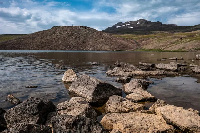
When the road up Aragats is open, roughly from June to October, Amberd fits easily into the same day as Lake Kari. Both lie on the same road.
If you're climbing the South Summit of Aragats, go up to the lake first so you can start on the trail early, before the midday clouds. Leave Amberd for the way back, in the afternoon. If you're not heading for the summit, you can swap the order: the fortress in the morning while the sky above it is clear, then the lake and lunch, and Byurakan and Yerevan in the evening. Details on the climb are in the guide to Aragats and Lake Kari.
Both stops are marked on the places map, and you can build the route in the route planner.
FAQ
How long is the drive from Yerevan to Amberd? About 50–55 km, a little over an hour via Ashtarak and Byurakan.
Can you drive to the fortress in an ordinary car? In dry weather, usually yes. The last stretch can be broken up or unpaved, so drive slowly. After rain, in a low car it may be easier to leave it below and walk up.
Is Amberd open in winter? The fortress itself never closes, but from November to April the road to it is usually snowed in and impassable.
How much time do you need for the visit? About an hour for the church, the citadel and the walls. With photo stops and tea from a thermos, an hour and a half.
What else is nearby? Lake Kari and the South Summit of Aragats higher up the same road, and the Byurakan Observatory on the way.
In short
Amberd is a little over an hour from Yerevan via Byurakan, at about 2,300 m. People come for the Vahramashen church of 1026 and the citadel walls above two gorges. The road is open from late spring to mid-autumn, and the last stretch can be rough. The fortress pairs most easily with Lake Kari.