
Mount Aragats and Lake Kari: driving from Yerevan and hiking the South Summit
Aragats, Armenia's highest mountain, and Lake Kari at about 3,200 m: the road from Yerevan via Byurakan, when it opens for the season, the South Summit hike, weather, what to wear and how to add Amberd.
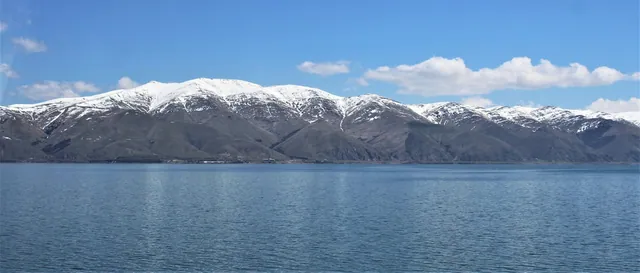
On almost any clear day you can see Aragats from Yerevan: a broad massif with four peaks northwest of the city. It is the highest mountain in modern Armenia. The North Summit rises to roughly 4,090 m, and the South Summit, at about 3,880 m, is the most accessible of the four. Nearly everyone heading up starts from Lake Kari at about 3,200 m. The lake is roughly 60–70 km from Yerevan, around an hour and a half's drive via Ashtarak and Byurakan, and the car takes you right to the shore.
What Aragats and Lake Kari are
Aragats is an extinct volcano. Its peaks stand around the rim of a huge old crater where snow lingers until midsummer. The North Summit is the highest, but the route to it is long: across the crater, over snowfields and rocky sections, a full day out, and not a place to go without mountain experience. The West and East summits are also harder than the South. The South Summit, on the other hand, is within reach of an ordinary fit traveller: the trail has no technical sections, only elevation gain and rocks.
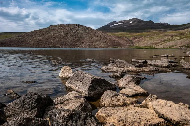
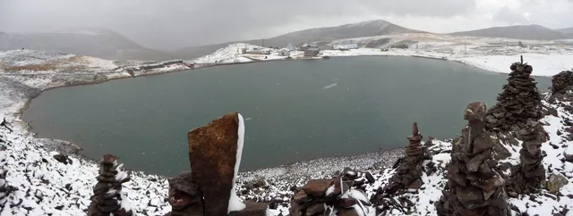
Kari means "stony" in Armenian. It is a small glacial-volcanic lake in a rocky bowl with almost no vegetation around it, just scree, moss and snow patches. On the shore stand the buildings of a high-altitude station where cosmic rays have been studied since Soviet times. In season a small café sometimes opens nearby, but not reliably. In summer herds graze around the lake and shepherds pitch tents on the slopes. Their dogs are serious: keep your distance from the flocks and do not approach them with food.
Plenty of people drive up with no plans for the summit, just for the road and the cool air. In July, when Yerevan is over 35 °C, it can be 10–12 °C up here, with wind.
How to get to Lake Kari from Yerevan
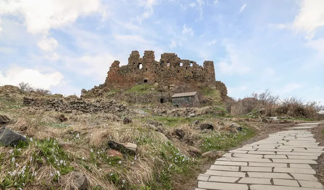
Leave Yerevan heading northwest towards Ashtarak, then follow the signs to Byurakan. The road climbs through the village past the Byurakan Observatory and then winds up the slope in switchbacks. On the way you pass the turn-off to Amberd fortress; remember it if you want to combine the two.
After the Amberd turn-off the road keeps climbing all the way to the lake. The asphalt is good in places and old in others, with potholes and patches. The last few kilometres run across an open slope with few guardrails, and fog can roll in within ten minutes.
| From | Distance | Driving time |
|---|---|---|
| Central Yerevan | about 60–70 km | about 1.5 h |
| Byurakan | about 30 km | 40–50 min |
| Amberd turn-off | about 20 km | about 30 min |
Distances are approximate; times assume a dry road and an unhurried pace. On the switchbacks above Byurakan you can't drive fast, and there's no need to.
What car you need
In summer, in dry weather, people usually reach Kari in an ordinary sedan. Drive slowly, steer around potholes and don't scrape the underbody on roadside rocks. A crossover with higher ground clearance is more comfortable here, especially early and late in the season, when rain washes mud and gravel onto the asphalt.
Altitude affects the car too. At 3,000 m the engine pulls noticeably weaker, so keep a low gear on the climbs. On the way down, don't ride the brakes; use engine braking.
When the road is open
The season is short. Snow usually clears from the upper road by June, and it normally closes in October with the first snowfalls. Exact dates vary from year to year: some Junes there are still drifts taller than a car by the lake, and some years the road is already shut in early October.
Check the road before you go. The most reliable way is to ask in Byurakan or look for fresh reviews and photos from the last few days. In the shoulder season, even when the road is officially open, the upper section can be icy in the morning.
For more on how mountain weather changes month by month, see the guide on when to visit Armenia.
Hiking to the South Summit
The trail starts at the lake and heads north up a rocky slope. It may not be waymarked along its whole length, but in season the path is well trodden and there are usually cairns, small stone piles, along the way.
Route benchmarks:
- Distance about 5 km one way; different tracks give 4.5 to 6 km.
- Elevation gain about 700 m, from 3,200 to roughly 3,880 m.
- Time 2.5–3 hours up, about 2 hours down. If you have no experience walking at altitude, allow more.
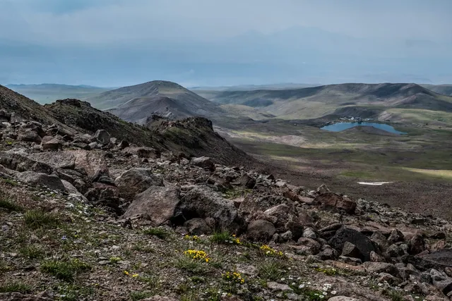
The first part is gentle, over scree and grassy patches. Then the slope steepens, with large rocks underfoot and, in places, snowfields that are still there in July. The final stretch follows the crater rim, and from the summit you look down into the snowy bowl with the North Summit opposite. On a clear day you can see Ararat to the south.
In summer the weather over Aragats follows almost the same pattern every day: clear in the morning, clouds building by noon, often a thunderstorm in the afternoon. Leave the lake no later than 7–8 am, and turn back if dark clouds are already growing over the summit, even if you are close. A thunderstorm on an exposed ridge is dangerous.
At this altitude many people get mild altitude sickness: headache, shortness of breath, heavy legs. Walk slowly, drink often and don't rush the last steep section. If the headache gets worse and you feel nauseous, go down; it usually eases at lake level.
What to bring
The weather at the lake and on the summit is nothing like Yerevan's. Even in August you can get snow pellets up top.
- A windbreaker and a warm layer, fleece or a light down jacket.
- A hat and gloves, especially for an early start.
- Boots with stiff soles. Trainers slip on big rocks and snowfields.
- Sunscreen and sunglasses. At altitude the sun burns quickly, and snow reflects the light.
- Water, at least 1.5–2 litres per person, and food. There are streams along the way, but don't drink from them without a filter.
- Trekking poles help on the descent.
There is usually mobile signal at the lake; higher up it is patchy. Download an offline map with the track and tell someone in Yerevan when you plan to be back.
If you're not going to the top
Kari is worth the drive even without the summit. You can walk around the lake in half an hour, climb the nearest hill above the station for a view over the bowl, and have something hot in the café if it's open. On the way back, stop at Amberd and in Byurakan.
If you just want a look at the high mountains without a long hike, half a day is enough. If you're going for the summit, set aside a full day and leave Yerevan around 5–6 am.
Aragats, Amberd and Byurakan in one day
Everything lies on the same road:
- Early start from Yerevan and the drive up to Lake Kari.
- Climb the South Summit and be back down by lunchtime.
- On the way back, Amberd fortress at about 2,300 m. The turn-off is lower down the same road.
- Byurakan and an evening drive back to Yerevan.
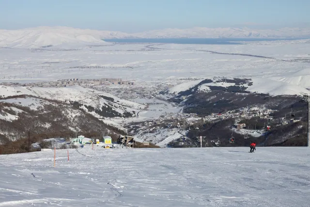
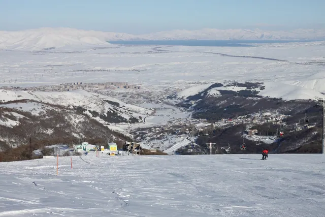
You can line up the stops in the route planner, and Aragats and Amberd are also on the places map. If you come to Armenia in winter, when the road to Kari is closed, you can see the mountains from another side: on the cable car in Tsaghkadzor.
FAQ
How long is the drive from Yerevan to Lake Kari? About 60–70 km, roughly an hour and a half. The road goes via Byurakan, and the upper part winds up an open slope.
Can you drive to Kari in an ordinary sedan? In summer, in dry weather, usually yes, if you drive carefully. Early and late in the season, after rain and early in the morning when there may be ice, a car with higher ground clearance is more comfortable.
When is the road to the lake open? Usually from June to October. Dates change from year to year, so check the road before you set off.
How long is the hike to the South Summit of Aragats? About 5 km one way with about 700 m of elevation gain. The ascent takes 2.5–3 hours, the descent about two.
Do I need a guide? In clear weather and at the height of the season many people climb the South Summit on their own. In fog, with snow on the trail, or without mountain hiking experience, it's better to go with a guide or with someone who knows the route. Don't attempt the North Summit without experience and gear.
In short
Lake Kari is an hour and a half from Yerevan via Byurakan, and the road is open roughly from June to October. From the lake it's about 5 km and 700 m of ascent to the South Summit of Aragats; start early, before the afternoon storms. Bring warm clothes even in July, and stop at Amberd on the way back.